Washington State Elevations with County Boundaries
Adapted with permission from The Johns Hopkins University Applied Physics Laboratory

Washington State/County Elevation Image

August 23, 1996
V2.2 copyright 1995 Ray Sterner, The Johns Hopkins University Applied Physics Laboratory
http://fermi.jhuapl.edu/states/

ZOOM OUT TO STATE VIEW

VEGETATION MAP IMAGE
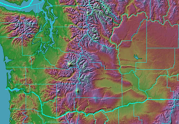
     ELEVATION MAP IMAGE WITHOUT COUNTIES
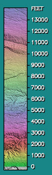
Key to Digital Elevation Maps

Elevation

The shaded relief maps are not satellite images. They are created from arrays of elevation data. The elevation data was derived from contour maps elsewhere, some is available from the USGS.

The Map Projection is Cylindrical Equidistant with the shape corrected for mid-latitude of the map.

Lighting is from the northwest.

The elevation data has a horizontal resolution of 1/2 arc minute in both dimensions and a vertical resolution of 20 feet.

The coastlines, rivers, and boundaries are from the CIA database.

County map boundaries are from the USGS Digital Line Graph files.


Text and image adapted by John J. Longfellow for WWW.GETREAL-ESTATE.NET

With permission from The Johns Hopkins University Applied Physics Laboratory web site
WWW Home page: http://fermi.jhuapl.edu/states/

Home     Sell Property     Homes     Land     Commercial     Search     Resources     Gallery

Get Real Estate: Land, homes, and commercial property in Klickitat County, Goldendale Washington Area
Sally Naught, Washington State Licensed Real Estate Broker:
509 896-5500 getreal@WildBlue.net